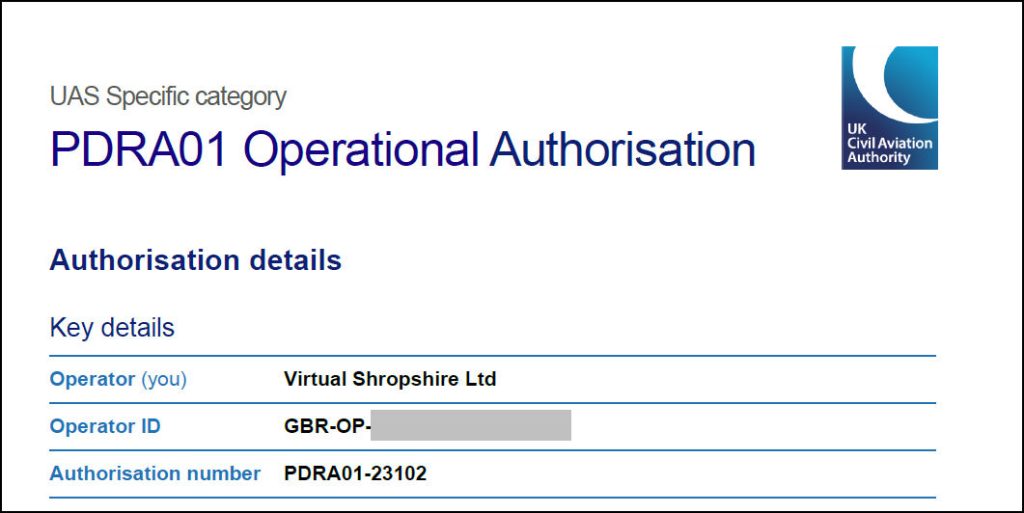
Virtual Shropshire Drone Rangers are based in the beautiful market town of Much Wenlock. We hold a General VLOS Certificate (GVC) and an Operational Authorisation certificate issued by the Civil Aviation Authority (CAA reference PDRA01-23102).
All flights are conducted in accordance with the Air Navigation Order and we are fully insured for commercial aerial work.
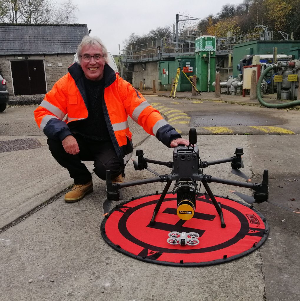
Our remote pilot is Virtual Shropshire’s owner Paul Hutchinson, assisted by trained observers Susan and Maggie. Paul has been flying drones since 2013 and acquired his first commercial qualification in July 2015.
Flight Safety
Safety is our prime consideration for all flights. We undertake a series of procedures to ensure each flight can be conducted with minimum risk to persons or property.
These include risk assessments & method statements (RAMS), site surveys, pre flight checks etc. During the flight our trained observers will ensure members of the public are kept at a safe distance from the area of operation.
Our observers will also bee keeping an eye on anything else in the air that might pose a hazard to our flight., such as other aircraft and birds!
This website uses cookies to improve your experience. We'll assume you're ok with this, but you can opt-out if you wish.AcceptRead More
Privacy & Cookies Policy
Privacy Overview
This website uses cookies to improve your experience while you navigate through the website. Out of these, the cookies that are categorized as necessary are stored on your browser as they are essential for the working of basic functionalities of the website. We also use third-party cookies that help us analyze and understand how you use this website. These cookies will be stored in your browser only with your consent. You also have the option to opt-out of these cookies. But opting out of some of these cookies may affect your browsing experience.
Necessary cookies are absolutely essential for the website to function properly. This category only includes cookies that ensures basic functionalities and security features of the website. These cookies do not store any personal information.
Any cookies that may not be particularly necessary for the website to function and is used specifically to collect user personal data via analytics, ads, other embedded contents are termed as non-necessary cookies. It is mandatory to procure user consent prior to running these cookies on your website.